Thursday, October 27, 2011

Pagami Creek Fire. First Pictures of Lake Two and Lake Three Area

As of 10/22/2011 the fire was 93% contained.  That day was the last official update from the Forest Service on the Fire.

  • TODAY'S MESSAGE: The fire remains 92,682 acres and 93% containment. All divisions on the Pagami Creek Fire are in aerial patrol status and the fire itself is unstaffed. A few remaining back haul items need to be retrieved from the fire line and rehab of some areas on the fire line continues. Crews and other resources continue to be released. Providing for firefighter and public safety is a primary concern. Mild afternoon weather is expected today. Winds are expected to be about 3-5 mph out of the North/Northwest, then switching to the South later in the day, with afternoon temperatures about 48-53 degrees.
This will be the last daily update provided for the Pagami Creek Fire unless fire circumstances change in the future. Please contact your local Superior National Forest office for information regarding the Pagami Creek Fire after today.

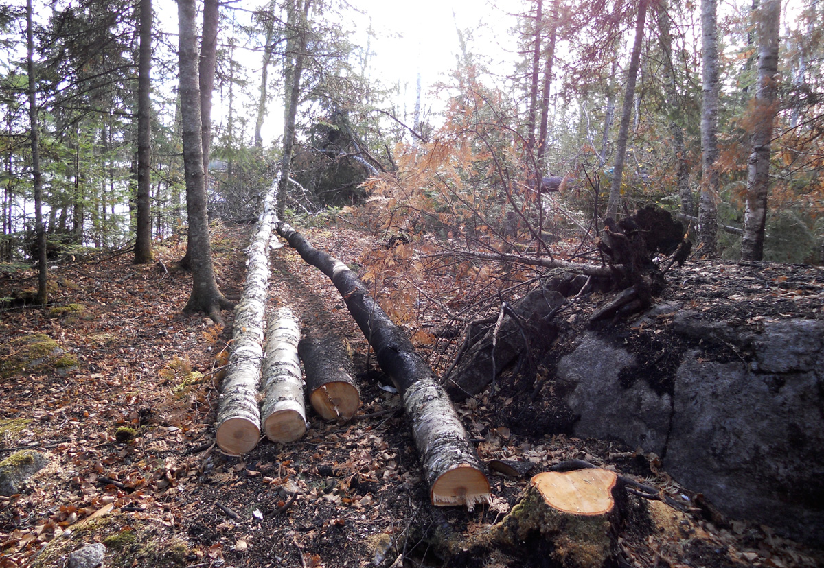
This past Monday, Steve Johnson and some other representatives from Outfitters were invited to accompany the Forest Service as they went into the Lake One Area.  Out of this trip we've gotten our first look at the fire touched closure areas that came first hand.  Overall, Steve Johnson said that he came away more encouraged than discouraged and saw many signs of greening up, wildlife and a forest carrying on with life.  In some places, as you'll see, that means little or no obvious change to a canoe camper's immediate surroundings.  In other places the campsites were drastically wounded.  Some campsites will appear normal but have different views across the lake than campers are accustomed to.  As the natural course of action after a fire, some areas will appear much more open to the naked eye until the new growth begins to fill those areas.  We are encouraged by what he discovered and are anxious to paddle all the routes within the closure zone as soon as we can.

Discover and enjoy:
Lake Two Looking back at the portage to Lake One

Lake Two

Lake Two
Looking across to the other side of Lake Two


Lake Two - Eagles used to hang out here

Another view of the Eagle's hangout.
A Campsite on the South side of Lake Three

A Campsite on the South side of Lake Three

A Campsite on the South side of Lake Three

Looking out at Lake Three from Campsite near South End
Another campsite on the South End of Lake Three that didn't fare so well.

Same burnt Lake Three Campsite

Another view of an area that the fire hit harder than some.
Click on pictures for larger view on any of these pictures.

Friday, October 14, 2011

Boundary Waters Fire 89% Contained

Pagami Creek Fire
Friday, October 14, 2011
Phone: 218-365-3177, 8:00 a.m. - 8:00 p.m. E-mail: PIOPagamiFire@gmail.com
Website: www.inciweb.org/incident/2534

Photos: https://picasaweb.google.com/112717872039965407359

see great pictures here


TODAY'S MESSAGE: Containment for the Pagami Creek fire has grown to 89%. The fire remains 92,682 acres in size. Rain fell across the entire fire area yesterday and some parts received over 1” of precipitation. Fire crews continued to work on line construction in the Ferne Lake and Bog Lake areas. Patrol and mop-up continued on the remainder of the fire. Some crews and resources are being released as containment of the fire progresses.
Cool, wet weather will return today. Strong NW winds are expected throughout the day. For the first time wind chill is entering the forecast and will make the temperatures feel 8 – 10 degrees cooler. Providing for firefighter safety is a primary concern and plans are in place to bring crews in if necessary. Crews will continue to construct fireline on the East side of the fire near Ferne Lake and on the southwest side of the fire near Bog Lake. Crews on the remainder of the fire will be focused on final patrol, mop-up and backhaul operations.
The Superior National Forest and the Minnesota Dept. of Natural Resources have lifted fire restrictions statewide.

ACTIVITIES TODAY
The West, North and Northeast portions of the fire crews will patrol and back haul un-needed equipment.
On the East portion of the fire crews will continue to build fire line near Ferne Lake
On the Southern portions of the fire near Isabella patrol, mop-up and back haul un-needed equipment.
On the Southwestern portions, line construction and reinforcement of existing lines will continue in the Bog Lake area. 
WEATHER: Cool temperatures are expected today with a high of 44 - 49 degrees. Relative humidity is expected to be between 59 - 65%. Winds will be NW at 10 – 15 mph increasing to 14 – 18 mph. Gusts up to 35 mph.

AREA/ROAD CLOSURES: The Superior National Forest has expanded closures for areas adjacent to the Pagami Creek Fire as a precautionary measure to provide for public safety. Travel along Lake County 7 and FR 369, FR 373 and FR 377 is open. The area between these roads and the fire is closed. To see the updated list of closures and closure map, please visit www.fs.usda.gov/goto/superior/home or www.inciweb.org/incident/2534.

FIRE RESTRICTIONS: Fire restrictions have been lifted statewide.  For details regarding fire use on the Superior National Forest see: www.fs.usda.gov/goto/superior/home.  For details regarding fire use and conditions in other areas of Minnesota, see: www.mnics.org

LOCATION: The fire started approximately 13 miles east of Ely.

CAUSE: Lightning

DETECTED: August 18, 2011

RESOURCES: There are currently 370 personnel assigned to the incident. Resources include: 3 hotshot (Type 1) crews, 6 Type 2 crews, 4 engines, 3 camp crews and other personnel. The following air resources are available: 2 Type 1 helicopters, 4 Type 3 helicopters, 2 CL 215, and three Beaver aircraft on floats.

Fire Ban Off. No fire Restrictions in the Boundary Waters

Closures of roads and lakes around the Pagami Creek Fire remain in effect.

Thanks for your help with informing visitors. We will remove fire restriction posters from the bulletin boards tomorrow.

Becca
Kawishiwi District

TERMINATION OF AN ORDER
FIRE RESTRICTIONS
SUPERIOR NATIONAL FOREST


Under authority of the Act of Congress of June 4, 1897, 16 USC 551, and pursuant to the Secretary of Agriculture’s Regulations set forth at 36 CFR 261.52 (a) and 261.52 (f), the prohibition listed in Order No. R909-11-22, applicable to the Superior National Forest, dated October 6, 2011, and signed by James W. Sanders, Forest Supervisor, is hereby terminated.


Dated this 13th day of October, 2011, Duluth, Minnesota.


___/s/James W. Sanders___
                                                          JAMES W. SANDERS
                                                          Forest Supervisor
                                                          Superior National Forest

Thursday, October 13, 2011

Boundary Waters Fire Update 10/13/2011

Pagami Creek Fire

Thursday, October 13, 2011

Phone: 218-365-3177, 8:00 a.m. - 8:00 p.m. E-mail: PIOPagamiFire@gmail.com

Website: www.inciweb.org/incident/2534

Photos: https://picasaweb.google.com/112717872039965407359

TODAY'S MESSAGE: The Pagami Creek Fire is 87% contained and remains 92,682 acres. Moderate temperatures and precipitation aided firefighting efforts yesterday. Crews completed fireline south of Fishdance. Line construction continued along the East side of the fire near Ferne Lake and on the southwest side of the fire near Bog Lake.
Precipitation is likely again today and cooler, wetter conditions will continue to aid firefighting efforts. Mop-up will begin in the Fishdance Lake area. Crews will continue constructing line in the Ferne Lake and Bog Lake areas. Crews will continue with mop-up and patrol and will begin to back haul over 75 miles of hose from areas of the fire that are contained.
Fire restrictions throughout the state remain in effect. No campfires are allowed except in designated, developed campgrounds. Campfires are restricted in the entire BWCAW. Please see below for additional information.

ACTIVITIES TODAY
On the West, Northwest, Northeast portions of the fire crews will mop-up, patrol and back haul un-needed equipment.
On the East portion of the fire crews will continue to build fire line near Ferne Lake
On the Southern portions of the fire near Isabella patrol, mop-up and line improvement continues.
On the Southwestern portions, line construction and reinforcement of existing lines will continue in the Bog Lake area. 
WEATHER: Higher temperatures will continue today with a high of 54-58 degrees. Relative humidity is expected to be between 68-74%. Winds will be W/SW in the morning becoming NW at 7 - 12 mph.

AREA/ROAD CLOSURES: The Superior National Forest has expanded closures for areas adjacent to the Pagami Creek Fire as a precautionary measure to provide for public safety. Travel along Lake County 7 and FR 369, FR 373 and FR 377 is open. The area between these roads and the fire is closed. To see the updated list of closures and closure map, please visit www.fs.usda.gov/goto/superior/home or www.inciweb.org/incident/2534.

FIRE RESTRICTIONS: Campfires and other open fires are restricted across Minnesota.  For details regarding fire restrictions on the Superior National Forest see: www.fs.usda.gov/goto/superior/home.  For details regarding fire restrictions and conditions in other areas of Minnesota, see: www.mnics.org

LOCATION: The fire started approximately 13 miles east of Ely.

CAUSE: Lightning

DETECTED: August 18, 2011

RESOURCES: There are currently 470 personnel assigned to the incident. Resources include: 8 hotshot (Type 1) crews, 7 Type 2 crews, 4 engines, 0 dozers, 1 water tenders, 3 camp crews and other personnel. The following air resources are available: 2 Type 1 helicopters, 4 Type 3 helicopters, 2 CL 215, and three Beaver aircraft on floats.

Wednesday, October 12, 2011

Boundary Waters Fire Update 10/12/11

Pagami Creek Fire
Wednesday, October 12, 2011
Phone: 218-365-3177, 8:00 a.m. - 8:00 p.m. E-mail: PIOPagamiFire@gmail.com
Website: www.inciweb.org/incident/2534
Photos: https://picasaweb.google.com/112717872039965407359

More Pictures Here


TODAY'S MESSAGE: The Pagami Creek Fire is 85% contained and remains 92,682 acres. Warmer day time temperatures and lower humidity led to moderate surface fire with occasional single tree torching yesterday. Crews are nearing completion of the line along the northeastern boundary of the fire near Fishdance Lake. Crews also continued with line construction on the eastern side of the fire near Ferne Lake and the southern portion of the fire near Bog Lake. Aviation resources supported fire crews with suppression activities and transport of supplies and back haul.
Precipitation is likely today and cooler, wetter conditions will aid firefighting efforts. Line construction will continue today in the Fishdance Lake, Ferne Lake and Bog Lake areas. Crews will continue with mop-up and patrol and will begin to back haul over 75 miles of hose from areas of the fire that are contained.
Fire restrictions throughout the state remain in effect. No campfires are allowed except in designated, developed campgrounds. Campfires are restricted in the entire BWCAW. Please see below for additional information.

ACTIVITIES TODAY
On the West and Northwest portions of the fire crews will transition to patrol and back haul un-needed equipment.
On the Northeast portions of the fire, hose-lays and line construction will continue as well as patrol and mop-up of previously constructed line.
On the East portion of the fire crews will continue to build fire line near Ferne Lake
On the Southern portions of the fire near Isabella patrol, mop-up and line improvement continues.
On the Southwestern portions, line construction and reinforcement of existing lines will continue in the Bog Lake area.

WEATHER: Higher temperatures will continue today with a high of 65 - 69 degrees. Relative humidity is expected to be between 66 - 72%. Winds will be South/southeast at 6 - 11 mph becoming southeast at 8 – 12 mph with gusts to 19 mph.

AREA/ROAD CLOSURES: The Superior National Forest has expanded closures for areas adjacent to the Pagami Creek Fire as a precautionary measure to provide for public safety. Travel along Lake County 7 and FR 369, FR 373 and FR 377 is open. The area between these roads and the fire is closed. To see the updated list of closures and closure map, please visit www.fs.usda.gov/goto/superior/home or www.inciweb.org/incident/2534.

FIRE RESTRICTIONS: Campfires and other open fires are restricted across Minnesota.  For details regarding fire restrictions on the Superior National Forest see: www.fs.usda.gov/goto/superior/home.  For details regarding fire restrictions and conditions in other areas of Minnesota, see: www.mnics.org

LOCATION: The fire started approximately 13 miles east of Ely.

CAUSE: Lightning

DETECTED: August 18, 2011

RESOURCES: There are currently 452 personnel assigned to the incident. Resources include: 8 hotshot (Type 1) crews, 6 Type 2 crews, 4 engines, 0 dozers, 1 water tenders, 3 camp crews and other personnel. The following air resources are available: 3 Type 1 helicopters, 3 Type 3 helicopters, 2 CL 215, and three Beaver aircraft on floats.

Followers